Introduction#
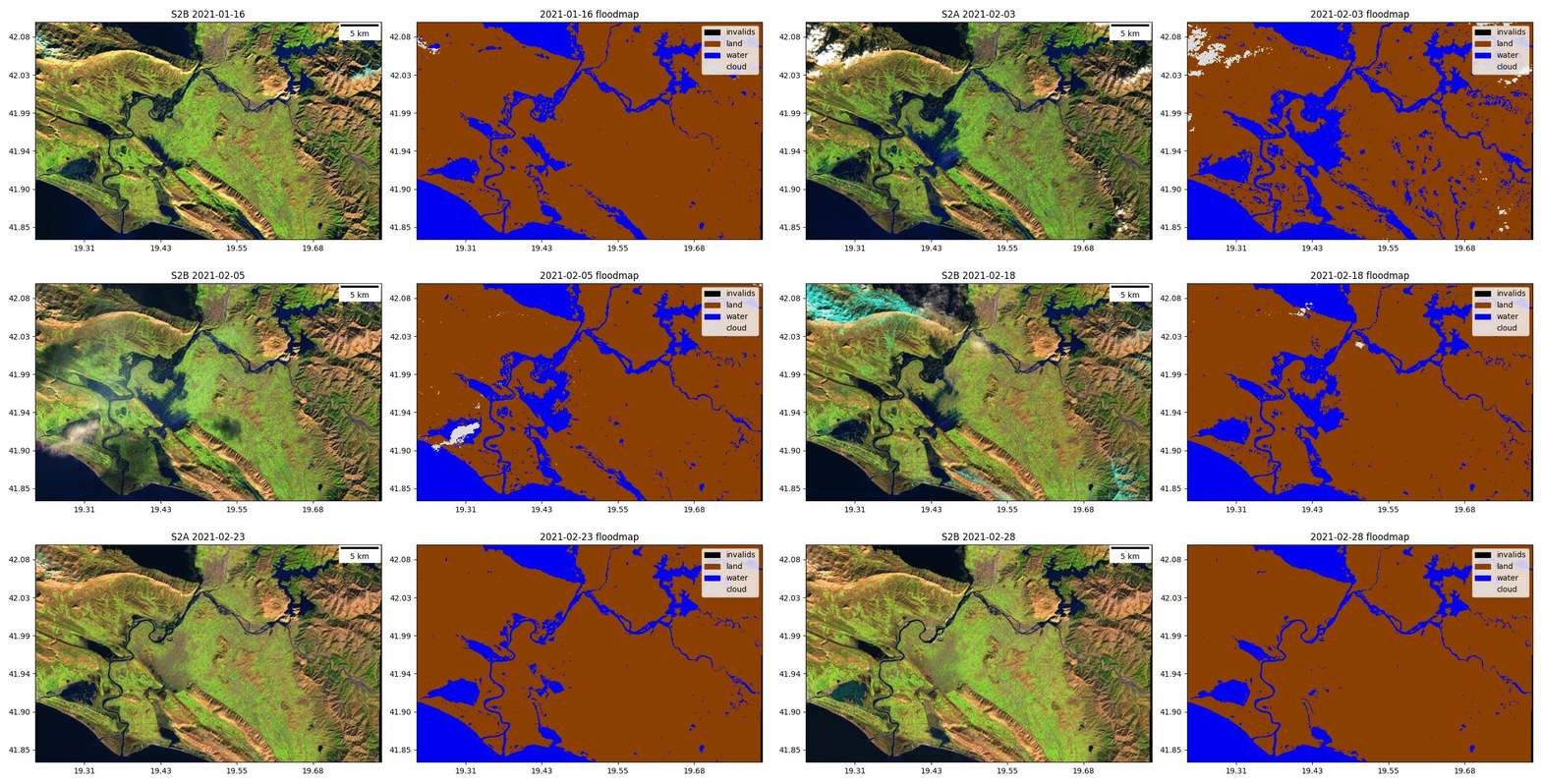
ML4Floods is python package to do end-to-end flood extent estimation from optical images using deep learning models.

Democratising AI-Enhanced Flooding Tools#
Machine learning (ML) algorithms have the potential to offer significantly faster and more accurate flood mapping than traditional methods. Their adaptability means they can easily grow to accommodate more data over time, and expand to ingest a wide range of data types. Training robust and reliable ML models is almost an art-form, requiring specialist knowledge of statistics, computing and data platforms. ML workflows have become much more accessible because of dedicated open-source libraries like PyTorch and TensorFlow. However, there are a myriad of subtle pitfalls associated with training and deploying ML models - these can produce deeply skewed results that still appear reasonable to the untrained eye. Democratising end-to-end integrated AI workflows avoids these pitfalls by creating a series of linked tools that non-ML expert users can trust to deploy machine learning. These tools incorporate data acquisition, preparation, calibration, enhancement and deployment steps, wrapped in an accessible interface.
Install#
To install the package run:
pip install ml4floods
Tutorials#
ML4Floods is a self-contained tool for training and deploying flood extent segmentation models for Sentinel-2 and Landsat. These tools include: image downloading, flood map acquisition, neural network training, testing and the visualization of the results in an interactive map. See the project rationale for a more detailed explanation of the goals of the tool.
These tutorials may help you explore the datasets and models:
About#
This work is an extension of the FDL Europe 2019 “Disaster Prevention, Progress and Response” team which results are published in:
G. Mateo-Garcia, J. Veitch-Michaelis, L. Smith, S. Oprea, G. Schumann, Y. Gal, Baydin G.A., Backes D. Towards global flood mapping onboard low cost satellites with machine learning. Scientific Reports 11, 7249 (2021). DOI: 10.1038/s41598-021-86650-z
FDL work has been further extended in the following paper where better models are proposed and trained on a curated version of the WorldFloods dataset.
E. Portalés-Julià, G. Mateo-García, C. Purcell, and L. Gómez-Chova Global flood extent segmentation in optical satellite images. Scientific Reports 13, 20316 (2023). DOI: 10.1038/s41598-023-47595-7.
Additionally, ML4Floods models have been deployed onboard a D-Orbit satellite where we conducted several experiments published in:
Mateo-Garcia, G., Veitch-Michaelis, J., Purcell, C., Longepe, N., Reid, S., Anlind, A., Bruhn, F., Parr, J., & Mathieu, P. P. , In-orbit demonstration of a re-trainable machine learning payload for processing optical imagery, Scientific Reports 13, 10391 (2023). DOI: 10.1038/s41598-023-34436-w.
ML4Floods has been funded by the United Kingdom Space Agency (UKSA) and led by Trillium Technologies. Additionally, this research has been supported by the DEEPCLOUD project (PID2019-109026RB-I00) funded by the Spanish Ministry of Science and Innovation (MCIN/AEI/10.13039/501100011033) and the European Union (NextGenerationEU).

Citation#
If you find this work useful please cite:
@article{portales-julia_global_2023,
	title = {Global flood extent segmentation in optical satellite images},
	volume = {13},
	issn = {2045-2322},
	doi = {10.1038/s41598-023-47595-7},
	number = {1},
	urldate = {2023-11-30},
	journal = {Scientific Reports},
	author = {Portalés-Julià, Enrique and Mateo-García, Gonzalo and Purcell, Cormac and Gómez-Chova, Luis},
	month = nov,
	year = {2023},
	pages = {20316},
}
@article{mateo-garcia_inorbit_2023,
	title = {In-orbit demonstration of a re-trainable machine learning payload for processing optical imagery},
	volume = {13},
	issn = {2045-2322},
	url = {https://www.nature.com/articles/s41598-023-34436-w},
	doi = {10.1038/s41598-023-34436-w},
	number = {1},
	urldate = {2023-06-27},
	journal = {Scientific Reports},
	author = {Mateo-Garcia, Gonzalo and Veitch-Michaelis, Josh and Purcell, Cormac and Longepe, Nicolas and Reid, Simon and Anlind, Alice and Bruhn, Fredrik and Parr, James and Mathieu, Pierre Philippe},
	month = jun,
	year = {2023},
	pages = {10391},
}

@article{mateo-garcia_towards_2021,
	title = {Towards global flood mapping onboard low cost satellites with machine learning},
	volume = {11},
	issn = {2045-2322},
	doi = {10.1038/s41598-021-86650-z},
	number = {1},
	urldate = {2021-04-01},
	journal = {Scientific Reports},
	author = {Mateo-Garcia, Gonzalo and Veitch-Michaelis, Joshua and Smith, Lewis and Oprea, Silviu Vlad and Schumann, Guy and Gal, Yarin and Baydin, Atılım Güneş and Backes, Dietmar},
	month = mar,
	year = {2021},
	pages = {7249},
}
Licence#
The package is available in GitHub. ML4Floods is published under a GNU Lesser GPL v3 licence  .
.
The WorldFloods database and all pre-trained models are released under a Creative Commons non-commercial licence

The Ml4Floods notebooks and docs are released under a Creative Commons non-commercial licence

Contributors#
Gonzalo Mateo-García, Enrique Portalés-Julià, Tarun Narayanan, J. Emmanuel Jonhson, Nadia Ahmed, Sam Budd, Satyarth Praveen, Lucas Kruitwagen, Margaret Maynard-Reid, Nicholas Roth, Cormac Purcell, Richard Strange, Leo Silverberg, Guy Schumann, Edoardo Nemni, Luis Gómez-Chova, Freddie Kalaitzis, Sara Jennings, Jodie Hughes and James Parr.
